

Quaddynamics
LiDAR Surveillance Drone
LiDAR Surveillance Drone
Couldn't load pickup availability
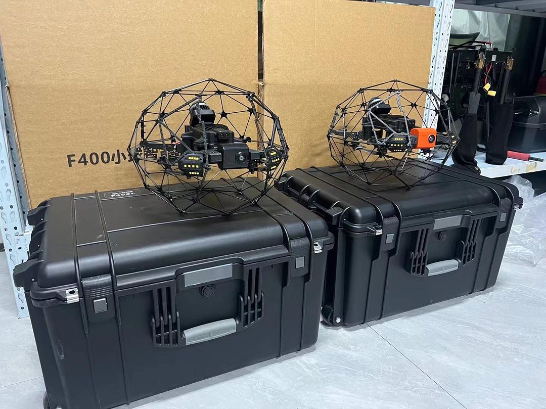
Ultra-Compact ISR Platform for Precision Military Operations
The 250-Size LiDAR Surveillance Drone is a highly portable, tactical UAV system built for front-line military use. Equipped with an advanced LiDAR payload, this drone delivers precise 3D terrain mapping, obstacle avoidance, and situational awareness in GPS-denied or complex environments—where accuracy and stealth are mission critical.
Designed for rapid deployment and operated by a single soldier, the drone is ideal for short-range ISR (Intelligence, Surveillance, Reconnaissance) missions in urban warfare, subterranean environments, and dense terrain. Despite its compact footprint, it provides actionable intelligence in real time, directly supporting ground units and special operations.
Military Applications
-
Urban Combat Reconnaissance
Navigate through alleyways, corridors, and buildings, providing LiDAR-based 3D scans and live video feeds for real-time threat detection and route planning. -
Tactical Mapping in GPS-Denied Zones
Operate effectively in GPS-jammed or underground environments (tunnels, bunkers) using LiDAR for autonomous localization and mapping (SLAM). -
Special Operations Support
Deliver detailed terrain models and structural layouts to support entry planning, hostage rescue, or breaching operations. -
Battle Damage Assessment (BDA)
Post-strike evaluation and structural scanning with centimeter-level accuracy to support rapid assessment and follow-up decisions. -
Covert Border & Perimeter Patrols
Conduct stealth surveillance of sensitive areas using low-acoustic profile and obstacle-aware navigation.
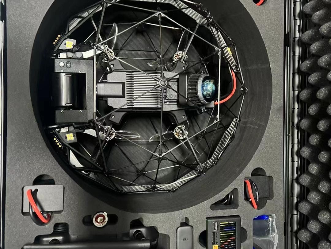
Key Features
-
Lightweight Tactical Frame (250-Size Class)
Optimized for stealth, agility, and confined-space operation—easy to carry in a rucksack or vest pouch. -
Integrated LiDAR Payload
Delivers real-time 3D environmental scanning for SLAM navigation, terrain modeling, and threat detection. -
Autonomous Navigation
Supports GPS-free flight using LiDAR-based positioning and intelligent obstacle avoidance. -
Secure Data Transmission
Encrypted telemetry and video feed to the ground control unit for mission security. -
Quick Launch Capability
Field-ready in under two minutes, allowing teams to deploy without delay.
Operational Edge
Whether operating in dense urban terrain, caves, forests, or built-up interiors, the 250-Size LiDAR Surveillance Drone gives dismounted units the power of advanced situational awareness in the palm of their hand. It’s a force multiplier—designed to enhance decision-making, reduce risk, and gain the tactical upper hand in the most demanding combat scenarios.
Share